
White Lake Township Neighbor Sources
There is no published White Lake Township neighbor roster. The useful record trail starts with a parcel and widens only as far as the source supports. Oakland County Property Gateway searches by property address or PIN and can be paired with the county's site-address and parcel layers. It can identify an address point, parcel context, and a reported owner, but an owner, a tax mailing address, and a current occupant are three different things.
| Block source | What it can show nearby | Access route |
|---|---|---|
| GIS site-address layer | Address points, PINs, street components, city, and ZIP | Public county map and REST layer |
| Parcel map and Property Gateway | Adjacent parcel shapes, owner or tax context, legal description | Address or PIN search; products vary by municipality |
| Qualified Voter File | Reported registrants, status, year of birth, and history after redaction | Michigan.gov/Vote or a scoped QVF request |
| Deed index | Transfer sequence and party names tied to neighboring parcels | Super Index from 1964, then office or archive routes |
| Association material | Voluntary boards, contacts, boundaries, and member-access information | Public association pages; complete directories are generally restricted |
Start with a single address and save its PIN, full situs address, legal description, and map placement. The county site-address layer represents an approximate point at a parcel's center, and multiple PINs or addresses can stack at one point. That means a map dot is not a count of people or homes.
White Lake Township Neighbor Parcel Map
The immediate-block method uses parcel geometry, not a presumed neighbor list. Search the target location in Property Gateway by a full or partial address, PIN, or map click. The county's official site-address layer carries PIN, street number, street name, city, ZIP, and address fields. Zoom to the street segment, then use the parcel polygon or map layer to see what actually touches the property. An address point is only an approximate center, so use the polygon edges before recording an adjacent lot.
- Find the White Lake address or PIN in Property Gateway and note the situs, legal description, and parcel number.
- Open the surrounding parcel polygons, recording only the parcels that touch the target or meet the stated map extent.
- Run each adjacent PIN through Property Gateway and keep the owner, mailing address, and situs in separate fields.
- Use the deed index when a transfer sequence matters, and follow its legal description rather than assuming a modern address appears in an older instrument.
For a full named-street chain rather than the nearby block, use the White Lake Township streets directory. The broader search adds address patterns, deeds, and earlier street evidence without treating a map view as a household count.
Note: A touching parcel can share a boundary, a subdivision, or a roadway, but it does not establish a relationship between the people connected with either parcel.
White Lake Township Neighbor Layers
Oakland County Enterprise GIS adds municipal boundary, school district, voting precinct, ZIP area, municipal tax district, special tax district, county area, and legislative layers around a parcel. This makes the White Lake Township block search more precise where lake edges and postal labels complicate a street address. The county site-address layer keeps city and ZIP as separate fields, and its ZIP field has five characters. A postal label can therefore differ from the legal township geography shown by the parcel boundary.
Water matters here. White Lake Township has 21 lakes and 3.5 square miles of water within its reported 37.2 square miles. A lake association boundary, subdivision, postal label, and township line may not coincide. The layers can explain why two nearby addresses carry different city or ZIP labels, but no layer proves that everyone connected with a parcel lives there.
Map-reading tip. Preserve the PIN and legal description whenever a lakefront, easement, lot, or section boundary makes a modern street address ambiguous.
White Lake Township Neighbor Voter Records
Michigan's public voter rules are useful only for a narrow, lawful question. A Qualified Voter File request can include complete name, residential and mailing address when available, year of birth, registration date, voter status, voter ID, and voter history when available and requested. The request identifies the desired jurisdiction or list, fields, date range or election-history scope, and delivery preference. Electronic QVF data is not emailed; the current form describes encrypted-drive pickup or FTP delivery.
The election record is a registration snapshot, not a list of every neighbor. Month and day of birth, IDs, phone, email, signatures, certain administrative fields, and Address Confidentiality Program applications are protected. Party choice is not public in this non-party-registration system. An old registration can remain tied to a former address under limited election rules, so status and date need to be read before a block result is connected to a current White Lake household.
White Lake Township Neighbors at Lakewood
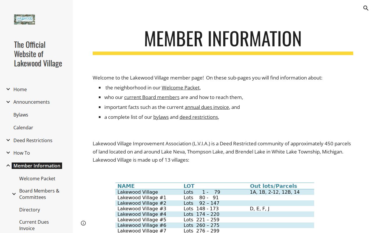
Lakewood Village Improvement Association offers a local example of how a community boundary can be more meaningful than a street name. The association describes a deed-restricted community of approximately 450 parcels on or around Lake Neva, Thompson Lake, and Brendel Lake, organized into 13 villages. Its public member-information route links a welcome packet, board contacts, annual dues, bylaws, and deed restrictions. A complete member directory is not publicly exposed.
The Lakewood Village member-information page shows the association's public contact and document route.
Association material can help identify a community's voluntary structure or relevant deed restrictions. It should never be treated as a public resident roll, and member-only content should remain subject to that organization's access rules.
White Lake Township Association Routes
Community groups supply context that parcel records cannot. Their public pages may identify representatives, events, dues, or a welcome packet, while full member lists may require access or are not posted. Lakewood and Long Lake are particularly useful geographic cues because the water and subdivision names may appear in deeds, newspapers, easement records, or association materials. Search those names alongside the parcel's legal description, not as substitutes for it.
| Association | Publicly described scope | Public route and limit |
|---|---|---|
| Lakewood Village Improvement Association | Approximately 450 parcels around Lake Neva, Thompson Lake, and Brendel Lake in 13 villages. | Member information provides packet and board routes; no full public member directory is shown. |
| Long Lake Homeowners Association | Lake-wide civic association spanning Commerce and White Lake townships. | Association site lists representatives, events, and annual dues; it is not a household list. |
| Other local associations | White Lake Citizens League, Brentwood HOA, and Mariners Cove HOA appear in local community or township material. | Public boards or documents vary; member records are voluntary or access controlled. |
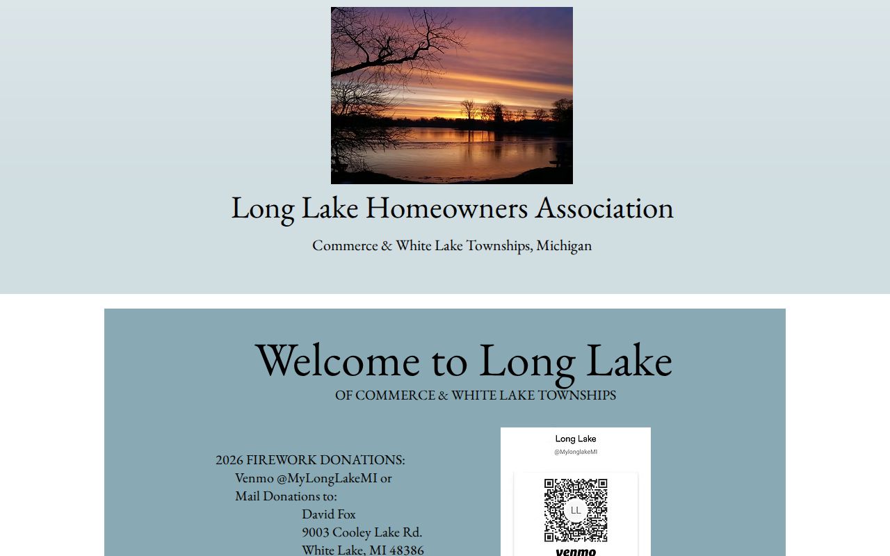
The Long Lake Homeowners Association makes the cross-township point visible: White Lake and Commerce Township can share a lake community even when their legal government and parcel records are separate.
Check the county boundary and parcel records for each address before connecting a lake-group reference to White Lake Township. Shared civic geography is useful background, not proof of a person's address.
White Lake Township Sources Compared
Official record systems and commercial neighbor tools answer different questions. An official parcel layer identifies an address point or parcel and links it to county property context. A deed index preserves legal transfers. An association page describes only the community information it chooses to publish. Commercial tools may combine public indexes, marketing data, and user-supplied material, which can merge similar names or retain stale addresses. They do not replace the office that owns the record.
| Source type | Strength on a White Lake block | Key limit |
|---|---|---|
| Official parcel and deed records | Parcel identity, legal description, transfer and tax context. | Ownership is not occupancy, and historical records may require an office or archive. |
| Voluntary association material | Community boundary, board, public notices, and shared lake or subdivision context. | Member directories are voluntary, limited, or access controlled. |
| Commercially compiled material | May suggest a name or past address to verify. | Can be inaccurate or stale and is not a custodian record. |
Property Gateway's free address and PIN search, its paid report or map products, an Assessor inquiry, and a Register counter answer different questions. When an official result and a compiled result differ, retain the official source, date, parcel, and search field used. A discrepancy belongs with the custodian or the individual company's correction process, not in a guess about who your neighbors are.
White Lake Township Safety Registry
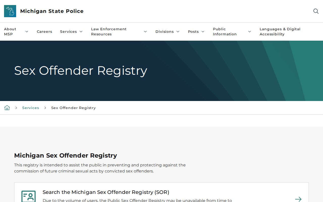
The Michigan State Police Public Sex Offender Registry is a distinct public-safety search, not a source for ordinary neighbor research. It allows name, registration or MDOC number, street address with city, county or ZIP, city/county/ZIP area, and neighborhood-map searches with a .25, .50, 1, 2, or 5 mile radius. The registry also distinguishes published, incarcerated, and non-compliant options. Its own record limits and public-safety purpose should control how a result is used.
The Michigan registry search displays the official modes for an address, area, or radius inquiry.
Verify a result with the appropriate law-enforcement or court source rather than relying on a copied entry. Juvenile and other nonpublic material is not included, and the registry does not establish every person who lives on a block.
Privacy Limits for White Lake Township Neighbors
Public block records have firm edges. A tax record does not identify every household member. A mailing address does not prove an owner's residence. Utility customers, delivery data, protected driver information, Address Confidentiality Program participants, and other confidential information are not neighbor-search fields. Michigan FOIA, MCL 15.231 et seq., provides a written-request path for public-body records, but MCL 15.243 permits privacy and other exemptions. Request a specific releasable record rather than trying to assemble protected data.
If a record is inaccurate, seek correction from the office that owns it. The Assessor handles tax-roll questions, the Register of Deeds handles recorded-document issues, the Township Clerk or Secretary of State handles voter records, and an association handles its own voluntary information. A correction to one compiled source does not alter the underlying public record.
Lawful use. White Lake neighbor research can support property curiosity, civic awareness, and community context. It must never be used to stalk, harass, intimidate, or expose a protected person.