
Search White Lake Township Streets
The useful White Lake Township street directory trail starts with the address, not a name. Oakland County Property Gateway accepts a property address or PIN, and its map-click route helps when a road or parcel is hard to describe in a search box. Record the site address, PIN, owner name when returned, mailing address, legal description, and map position. Then use the PIN and legal description to connect the same place to a deed, a township request, or a historical source. A mailing address may be far from the physical parcel, so it is a contact detail, not a statement about who occupies the site.
- Enter the full address, a partial street-and-number pattern, or the PIN in Property Gateway. Save the displayed site address and parcel identifier before trying other records.
- Open the map context and compare the parcel with nearby street names, boundaries, and address points. Note any city or ZIP label separately from the township location.
- Use the current owner and legal description to find the vesting instrument in the Oakland County Register of Deeds index. Treat the address as a clue because older instruments can rely on the legal description instead.
- For a narrow voter-record question, use the Michigan voter route or the Qualified Voter File request process. Read a registration result as a dated record, not a household census.
- When the question concerns an earlier occupant, pair the deed sequence with newspaper, census, and telephone-directory evidence. The regional volumes are described on the White Lake Township city directory collections page.
That order prevents a common mix-up. The address trail can establish how an address appears across records, but no one source answers ownership, residency, delivery, and past occupancy at once.
White Lake Township Street Directory Fields
Property Gateway is the first practical tool for a White Lake Township by-address search. Its public landing form is labeled “Search by PIN or Property Address,” rather than an owner-name directory. The portal requires at least five characters and documents partial patterns such as 1200 S or 123 S V. It also accepts percent-sign wildcards and multiple comma-separated PINs. Free and paid products vary by municipality, so a missing report option does not mean the parcel is absent. The White Lake Assessor is the better route for an owner-name question or an older tax-roll inquiry.
| Property Gateway control | Entry type | How it works | Street-use caution |
|---|---|---|---|
| PIN or property address | Text, five-character minimum | Accepts full or partial address and partial PIN. | Use the returned PIN to anchor the result. |
| Wildcard pattern | Text with % | Examples include 1% Main and 14011%. | Review each result rather than assuming a broad match is one parcel. |
| Map navigation | Map click | Navigate to a property and select it on the map. | Useful when an address format is uncertain. |
| Paper options and print scale | Print controls | Appear with report or map products. | PDF and delivery choices may be fee-based. |
White Lake reports about 12,300 real parcels and 530 personal-property parcels. The assessor identifies David Hieber and accepts taxpayer record requests by phone or in person, with additional material available through township FOIA. That local contact fills the gap left by the public landing screen, which did not display an owner-name field.
White Lake Township GIS Streets
Oakland County’s official GIS separates the street address from the legal parcel boundary. The site-address layer includes PIN, address number, street name, street type, full street address, city, state, ZIP, ZIP+4, and geometry. Its point marks an approximate parcel or address center. Multiple PINs or addresses can stack at the same point, which is why a map marker is not a list of people at that location.
The Enterprise GIS administrative layers add municipal, precinct, school, legislative, ZIP, tax-district, and county-area context. For a long road near a lake or township edge, those layers can explain why the postal city and legal township do not match. Use the parcel polygon for adjacency and the address point for structured address details. Neither one proves a current occupant.
See the official Oakland County site-address layer before using an address point in a White Lake Township street directory.
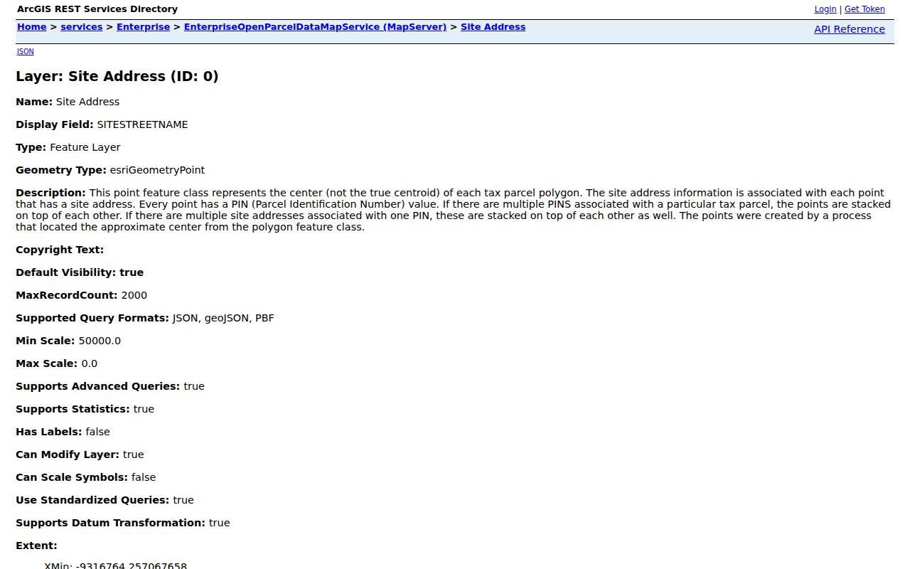
The field list shows why the PIN and full address are more dependable search keys than a postal label alone.
White Lake Township Street Deeds
A deed chain puts dates behind a White Lake Township street directory result. Begin with the parcel’s present legal description and identify the deed that placed the current owner in title. Search the seller as grantor and the earlier owner as grantee, then repeat with each prior instrument reference. A trust, estate, corporation, or several named parties requires the exact indexed name to be kept with the parcel notes. The modern street address may not appear in an older instrument, especially where a subdivision lot, a section-township-range description, or metes-and-bounds language was used.
The Oakland County Register of Deeds property and land service says Super Index copies reach back to January 1, 1964, except subdivision plat maps. Older material may require a Register of Deeds counter, archived volumes, microfilm, the Archives of Michigan, or the Library of Michigan. There is no verified all-record cutoff for every pre-1964 White Lake instrument, so do not label an online gap as a missing deed.
| Deed-index detail | Why it matters along a street |
|---|---|
| Grantor and grantee | Shows the parties and the direction of a transfer. |
| Recording or document number | Places the instrument in the public sequence and supports a copy request. |
| Legal description or PIN | Links a deed to a parcel when the street address changes or is omitted. |
| Instrument type | Separates deeds from mortgages, liens, releases, and other documents. |
Execution and recording dates can differ. Use the recording date for the public sequence, then read the image or certified copy for the detail the index does not show.
White Lake Township Street Records
Address-keyed sources answer different questions. A parcel record identifies the property and its tax context. A deed tracks title. A permit or code file can connect a project to an address, while an election record is limited to a registrant and its reported status. Reading the sources side by side keeps the White Lake Township street directory focused on what each custodian actually holds.
| Address record | White Lake or Oakland keeper | Street connection | Access route |
|---|---|---|---|
| Parcel and tax record | White Lake Assessor / Property Gateway | PIN, situs, mailing address, values, and tax context. | Address or PIN online; assessor inquiry or FOIA for more. |
| GIS address point | Oakland County GIS | Structured address, city, ZIP, and map point. | Public GIS layer and map service. |
| Land instrument | Oakland Register of Deeds | Party names, recording sequence, and legal description. | Super Index from 1964 except plats; older counter or archive route. |
| Permit or code file | White Lake Township | Address-specific project, notice, or inspection context. | Specific request, email, office, or FOIA route. |
| Voter record | Michigan Bureau of Elections / Township Clerk | Reported registration address and status after redaction. | Michigan Voter Information Center or QVF request. |
For a one-name confirmation instead of a whole street, the White Lake Township resident lookup uses the same custodians with a different, person-focused workflow.
White Lake Township Address Files
Some of the most specific street evidence is not in a public search box. White Lake building guidance says that, as of April 1, 2026, permit applications are processed by email or in person and are not available through BS&A Online. A file tied to a particular address may include an applicant, owner, parcel ID, project address, approvals, and inspection dates. It does not establish that the applicant is the current resident. The Building Division receives emailed applications at permits@whitelaketwp.com and sends an invoice and online-payment link for that route.
Ordinance Enforcement’s electronic complaint process requires a property address, and no public case-number search was located. Fire-record requests also require a specific address or parcel ID, not a general vicinity. White Lake Fire says computer incident reports go back to March 14, 2002, while an older manual lookup may be expensive. These local rules make a precise address and PIN much more useful than a broad street-only request.
White Lake Township Street Archives
White Lake Township began imaging documents and forms in 2013. That date marks a more useful online municipal trail, not the beginning of the records themselves. For a pre-2013 minute, notice, easement, ordinance, or form, ask the Township Clerk for the record series and date range. The Clerk keeps original township records and can direct a written request under the Michigan Freedom of Information Act, MCL 15.231 et seq. The statute normally gives a public body five business days to respond, with one ten-business-day extension allowed.
County land records, library collections, and the White Lake Historical Society add other fallback channels. The Historical Society’s appointment archive includes local newspapers and photographs, while the White Lake Township Library provides onsite Ancestry Library Edition, catalog access, MeL, and reference help. When a historical telephone book or newspaper uses an old label, retain that version with the PIN and legal description instead of forcing it into a current street format.
Note: The 2013 imaging date changes the online starting point, while the Clerk, archives, and libraries remain the route for older White Lake records.
White Lake Township Street Terms
Four small terms prevent a street search from drifting into assumptions. They also explain why a parcel report, plat, or older deed can use very different language for the same location.
- Parcel or PIN
- A parcel is the land unit tracked for tax and mapping. Its PIN is the county identifier that links an address to parcel records.
- Situs address
- The physical location of the parcel used for mapping and assessment. It is different from the address used for tax mail.
- Plat
- A recorded subdivision map that can identify lots, blocks, streets, easements, and related legal-description context.
- Criss-cross directory
- A historical reverse directory arranged by address, useful for an earlier address-to-name clue but not verified as a complete White Lake run.
An address search becomes more reliable when every finding is tagged as an address point, parcel fact, recorded transfer, registration record, or historical clue.
White Lake Township Street Edges
White Lake Township has water-shaped and boundary-sensitive address geography. Oakland’s layers can show the parcel with a municipal boundary, ZIP area, tax district, school district, and voting precinct, yet those layers do not always align. Five ZIP areas serve or intersect the township: 48327, 48350, 48382, 48383, and 48386. Waterford, Davisburg, or Commerce Township labels can appear near the edge, while the legal parcel may still be in White Lake Township. The county’s city field is separate from its ZIP field for this reason.
There is no verified township-wide street-renumbering or readdressing chronology. Preserve each observed street suffix, old route or rural-route notation, postal city, subdivision, lot and block, section-township-range, PIN, and recording date. Planning and the Clerk are the local contacts for street-name or legal-description questions. This careful record of variants is especially important for lakefront land, where an easement or lot description can be more stable than a house number.
See the official Oakland County administrative GIS layers for the municipal, ZIP, precinct, and tax-district choices used beside a street result.
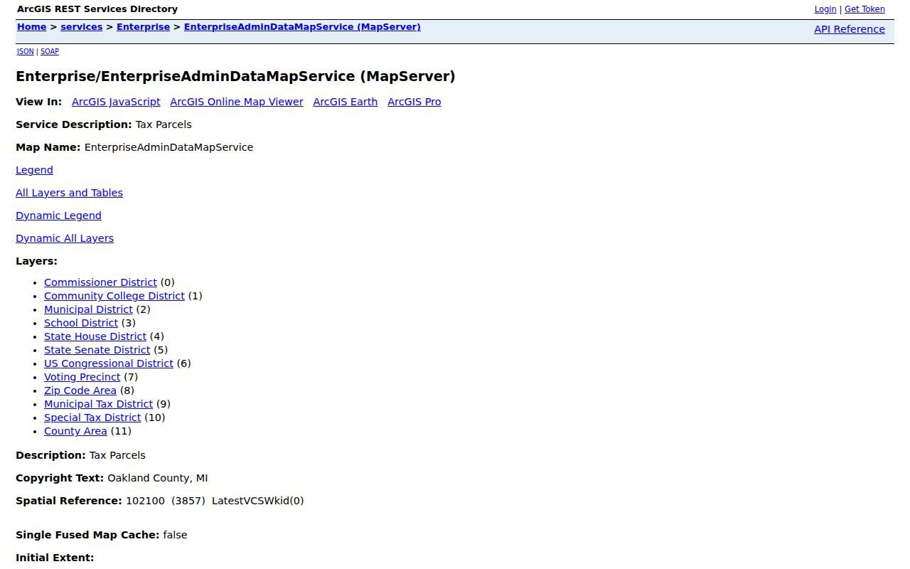
The administrative layer list helps separate the map context of a road from a claim about a resident at one address.
Limits of White Lake Township Streets
A White Lake Township street directory cannot identify every person behind every door. Owner records omit many non-owner household members. A tax mailing address is not proof of residency. Utility customers, delivery records, private driver information, protected addresses, and most household details are not public street-directory fields. A no-result may reflect an address-format mismatch, a closed or unindexed record, an older record stored offline, or a person who is not named in the particular file.
Michigan voter information also has required redactions. Public-file rules protect month and day of birth, phone and email information, identification numbers, signatures, and Address Confidentiality Program applications. The individual Michigan Voter Information Center is an official entry point, while broader lists use the state QVF request route. Use a record only for a focused, lawful question and verify a meaningful finding with the office that holds it.